In Spring 2021 the City of Quincy published the first maps of the Presidents Trail. This historic walking trail connects several of the city’s places of interest from its colonial history, many related to the lives of John and John Quincy Adams, the United State’s second and sixth Presidents, that called present-day Quincy their home.
During Fall 2021 worked with the City of Quincy and the City’s Chamber of Commerce to explore new ways in which this nascent walking trail could be leveraged to unfold new kinds of value for both visitors as well as local residents.
The comprehensive work of this collaboration is documented in a book available in print and as a pdf available here for download:

Based on several field trips along the trail, conversations with City officials, Adams National Historic Park staff, residents, visitiors, and other stakeholders, the below vectors for opportunities emerged.
Vectors of Opportunity
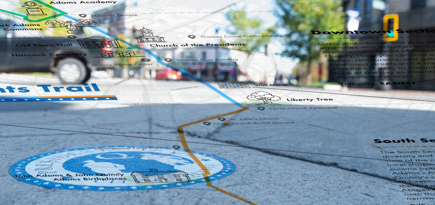
By exploring these vectors of opportunities, the teams developed a number of project proposals. Since the conclusion of this studio, the City of Quincy has implemented numerous of the proposals that came out from this studio such as re-routing the trail between Quincy Center and the Peace field historic site, articulating the trail in a North, Downtown, and South section for easier walkability. And finally, the City and Chamber of Commerce organized several events to activate the trail.
| Marking the Trail Making the trail findable when close-by and recognizable when walking along it. Indicating what comes next and what is nearby. Creating an identify of the trail as an experience while walking along it. | Guiding Along the Trail Fostering a sense of interest and curiosity to move forward along the trail. Enhance existing and create new attractors to facilitate trail exploration. Consider the trail as akin to a book that a visitor reads while walking through the urban fabric. | Living Trail Allow for the trail to evolve over time. Engage and connect local communities, citizens of all ages and local organizations through the trail and in an ongoing conversation. Connect the trail’s main storyline with other local histories. | Finding out about the Trail Making the trail discoverable from a distance and for new audiences. Enable trail visitors to bring something home from their trail experience that promotes trail awareness to others. |
| Mobility and the Trail Supporting moving to, from and along the trail by foot, bike, bus, train, trolley, mobility device, for different levels of ability in ways that are positive parts of the trail experience. | Connecting Existing Local Values Leveraging places of interest along the trail beyond the trail’s core sites. Integrating “hidden gems” along or nearby the trail in the visitor experience and connecting to local businesses, amenities, and organizations. | Living Trail Allow for the trail to evolve over time. Engage and connect local communities, citizens of all ages and local organizations through the trail and in an ongoing conversation. Connect the trail’s main storyline with other local histories. |
Marking the Trail
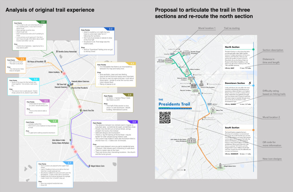
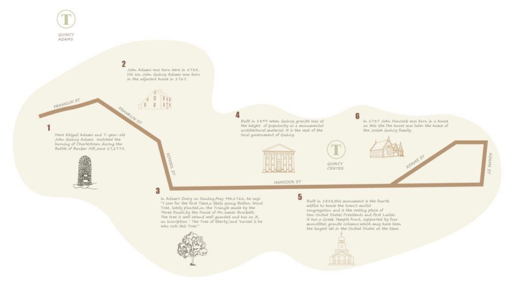
Analysis of original trail condition based on multiple field trip (left), and proposal for new course and map of the Presidents Trail. Key new elements include the articulation of the Trail in three sections (North, Downtown, South) for better legibility and walkability, and the re-routing of the North section to include the Freedom Park, dedicated in the 1977 Bicentennial of the Declaration of Independence.
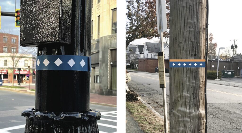
Leveraging existing poles for trail markings
While markings along the trail are fairly sparse, a significant number of utility and street light poles lines the trail’s sidewalks. The proposal is to leverage these existing poles by applying discrete but visible Presidents Trail markings akin to trail blazers – the tree signage found on hiking trails.
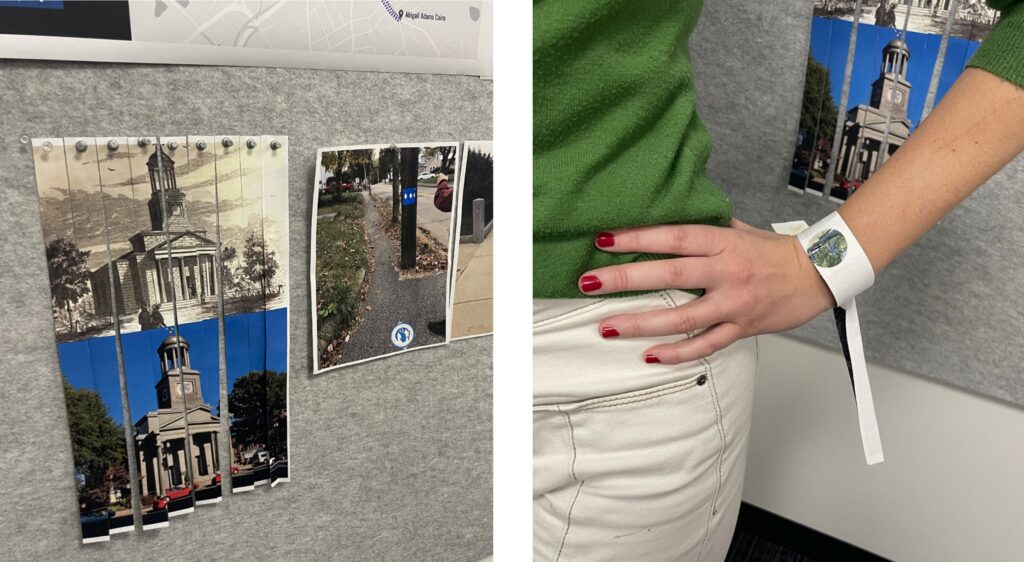
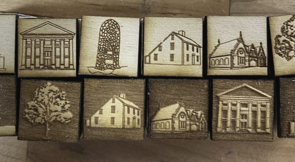
Wearable trail markings as collectibles
Prototype for wearables as walking trail markings and collectibles. Bands can be wrapped around visitors’ wrists as a signal to others that they are participating in the Presidents Trail. Collecting different bands at the various historic sites results in image collages to take home for memory.
Guiding Along the Trail
Beyond the marking of a walking trail and the visual tools for legibility of a trail such as maps, the act of guiding along a trail happens in concrete situations and physical contexts, embedded in the urban fabric. Three layers of guidance address the particularly critical moments of road crossings at intersection, locations where choices of direction need to be made, and the adding of virtual information layers accessible at specific locations.
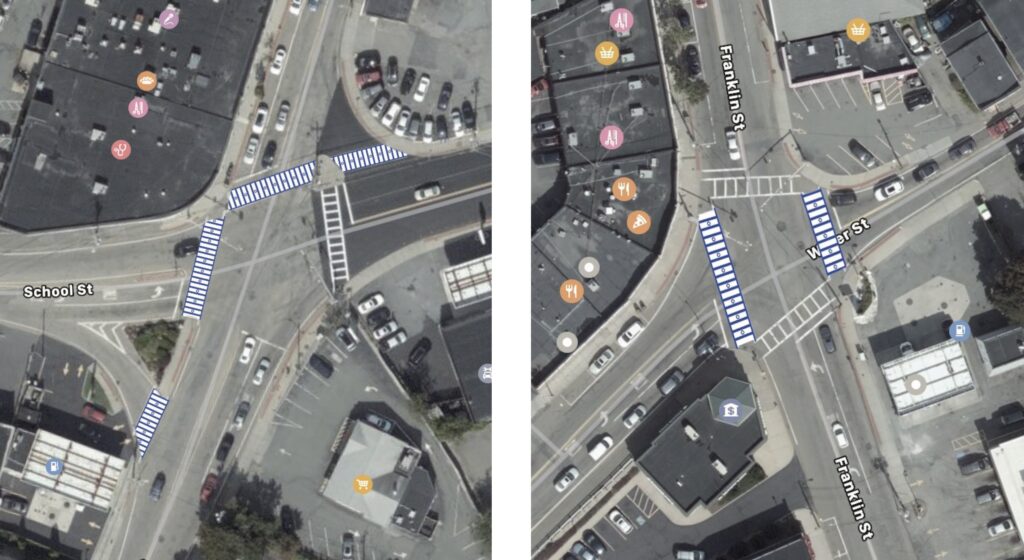
Visual Trail Crossings
Visual treatment of pedestrian crossings in line with the Presidents Trail visual identity to clarify guidance when crossing roads as part of the trail.

Waiting along the trail
Taking stock of time spent at traffic light managed pedestrian crossings along the trail.
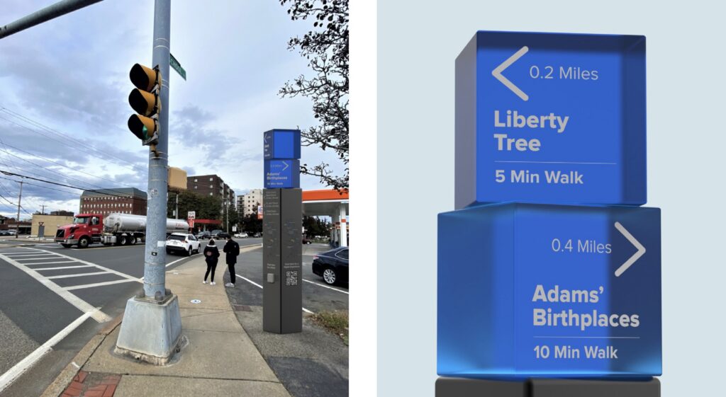

Lighthouse information and story totems at intersection
These information totems can be placed at intersections to provide three different functionalities: 1) provide guidance through visibility from a distance; the illuminated tops shine a light to guide walkers along the trail; 2) indicate the walking direction and distance to places of interest along the trail; 3) an audio button starts one of several stored short audio tracks about the place-based history for walkers while they wait for the green light at the traffic light.
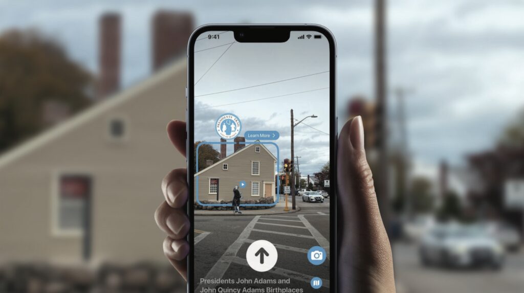
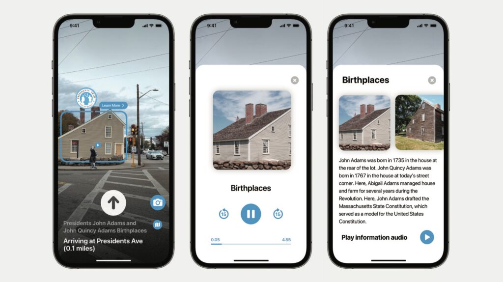
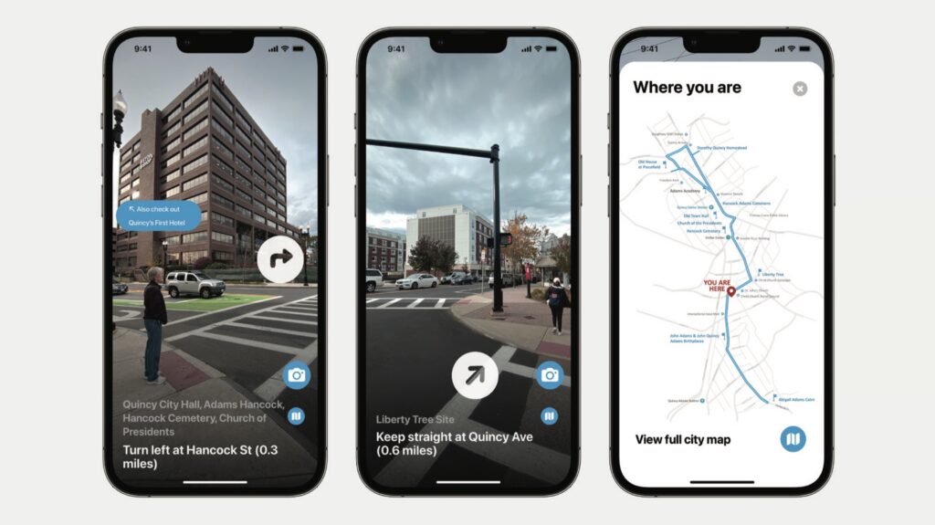
Navigating an urban trail in practice, today, also involves the use of digital map and navigation apps on people’s smartphones. Leveraging this, the proposal builds on digital mapping apps and offers augmented reality (AR)-based navigation clues along the trail. Furthermore, the same AR layer also provides information about historic sites along the trails. Given the AR-nature of this information specific places can be called out and referenced.
Trail of Activities
Thematic urban trails are an exciting and engaging way for people to learn about a place’s history. Visitors can immerse themselves in a location and learn through first hand experience. Places become memorable through active participation and discovery. Activity engages and generates stories that can be told and shared – memories that tie us to that place and time for years to come.

Community Gardening along the trail
Engaging with existing local communities, locations along the trail can be valorized by providing space to these community organizations for their activity. An example is the proposal for community garden installations in the currently underutilized Freedom Park. This kind of joint and hybrid utilization of public spaces furthers the opportunities for connections between residents and visitors.
The trail as a 5K running track
In addition to the exploration of a city’s history, the inherent nature of a trail is for people to move along it. As such, the trail lends itself quite naturally for activities centered around the simple act of
moving one’s body. This proposed activity brings the annual City of Presidents 5K race to the Presidents Trail. Closing off the trail from road traffic for the event day enables visitors and locals, runners, walkers, and audience members to move freely along the trail in an athletic as well as social spirit.
Treasure hunt along the trail
To engage young visitors and walkers along the Presidents Trail, this proposal leverages the joyful act of collecting stamps at every location visited. A treasure hunt map is provided for orientation and at each location of the trail walkers can add a stamp of that place of interest to their “Presidents Trail Logbook” to commemorate their achievement and for their memory.
Connecting local businesses through the trail
While the Presidents Trail sports many offerings of Presidential attractions, gardens and parks, it is also the place of many different businesses, small and large. The objective of this proposal is to offer means of diversifying the trail’s offerings for locals, businesses, and visitors. With a burgeoning trail as an opportunity for economic growth, the proposal is to connect local venues into the trail experience.
Based on research on existing businesses along the trail and underused spaces and storefronts, the proposal is for a catalog of curated experiences offered on the Presidents Trail. Using the Presidents Trail’s spatial profile as a catalyst, these offerings are a means of connecting local businesses to one another and creating significant, curated experiences for locals and visitors alike.

Establishment of a systems perspective of historic sites within a relational web of other places.

Research on existing businesses of more or less direct interest for trail visitors. Mapping of underused spaces and vacant storefronts that can be leveraged for special temporary initiatives.

Proposal of curated thematic trail experiences that can be promoted to visitors and that connect the Presidents Trail experience with local businesses and other nearby places of interest to expand the impact of the trail as a catalyst for local economic growth.
Team
Kristian Kloeckl (instructor), Aamil Amin, Zhiman Bai. Joshua Brown, Charalampia Gavra, Brittani Lebel, Rajeev Prasad, Rohan Tandon, Andrea Vo, Reid Weigner, Yue Yu, Luiza Zerlotti Demasi, Xuhui Zhang
Local Partners
Thomas P. Koch, Mayor at City of Quincy
Tim Cahill, President and Executive Director at The Quincy Chamber of Commerce
Robert Stevens, Deputy Planning Director at City of Quincy
Chris Walker, Chief of Staff at City of Quincy
Kelly Cobble, Curator at Adams National Historical Park, National Park Service